
News - Очікується крижаній дощ у метро Детройт після Різдва
Business Strategy
Очікується крижаній дощ у метро Детройт після Різдва
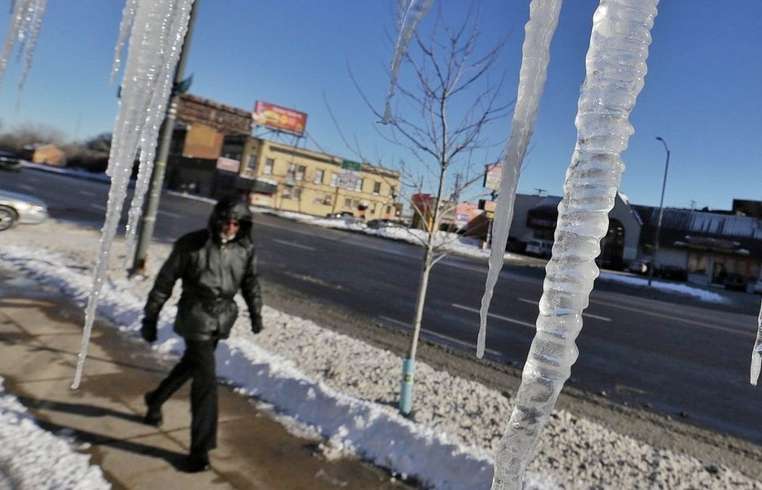
Residents of metro Detroit shouldn't expect a white Christmas this year, with the National Weather Service forecasting rain and freezing rain in the coming days. On the evening of December 24, weather predictions indicate a 20% chance of precipitation, with possibilities ranging from a light snow to a drizzle extending until 4 a.m. Christmas Eve temperatures will see a low of 34 degrees. Into Christmas Day, the forecast is partly sunny with temperatures peaking near 40 degrees and dropping to a low of 27 overnight. Wind gusts could reach up to 18 mph. The main weather concern begins on December 26, with projections of snow and freezing rain early, transitioning into rain or freezing rain. Ice accumulations could range between 0.1 and 0.3 inches, particularly in Detroit and extending into Oakland and Macomb counties. A light coating of ice, typically a quarter-inch or less, mainly serves as a nuisance and can obscure windshields and make outdoor surfaces, especially bridges, slick. However, heavier ice, approaching a half-inch, might disrupt daily activities, potentially damaging trees and power lines. Such ice storms are not unfamiliar to Michigan. In 2025, northern Michigan grappled with heavy ice accumulations of up to an inch and a half. Historically, Detroit's Christmas temperatures average highs of 33 degrees and lows of 22, with precipitation averaging 0.08 inches and snow accumulation at half an inch. Past records show that the warmest Christmas occurred in 1982 with a temperature of 64 degrees, while the coldest was in 1983, dropping to minus 10 degrees. Snowpack reached its peak in 1951 at 13 inches. Residents are advised to stay informed on weather conditions and take precautions against potential hazards posed by ice accumulation.
About usyoo

Categories
Tags